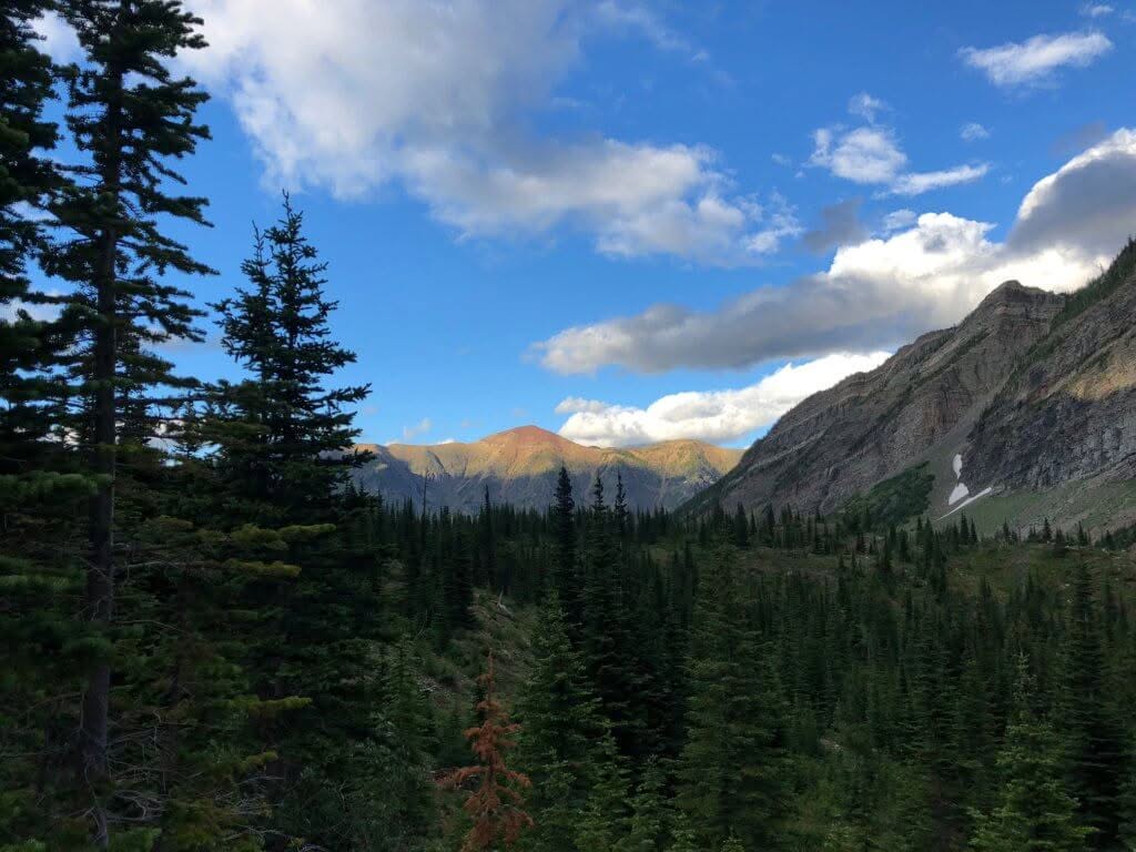
SEE THE CASTLE IN A WHOLE NEW LIGHT
ON FOOT OR BY SKI, THERE ARE MANY MAGNIFICENT PLACES TO SEE!
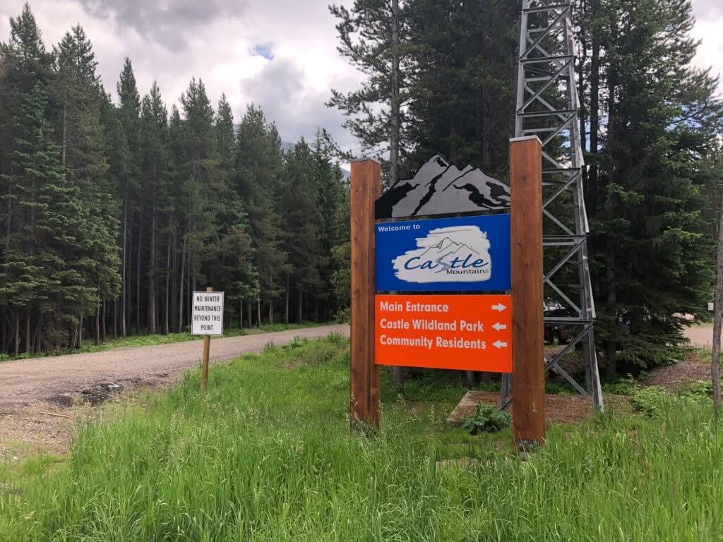
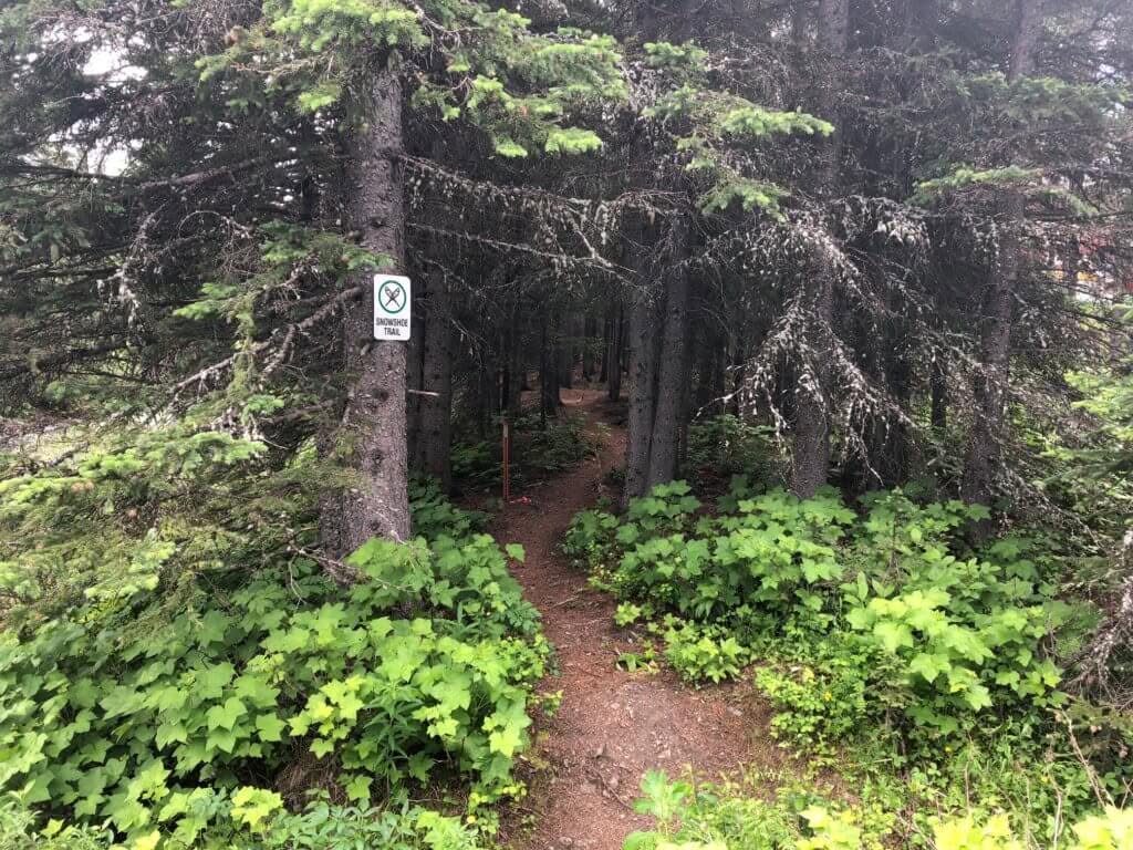
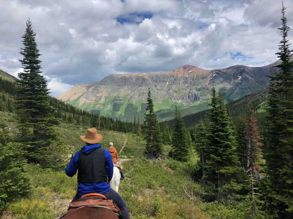
In the summer of 2017, in concert with the creation of the Castle Parks (Castle Wildland Park & Castle Provincial Park), Castle Mountain Resort started signing and maintaining a number of summer trails.
Whether you’re looking for an easy stroll along the Westcastle River, a moderate hike to one of two alpine lakes, or a strenuous hike to one of our ridge tops, there’s something for you here. The best part is, with the only food service in the park, you can celebrate with great food and drink at the T-Bar Pub after your hike!
CASTLE MOUNTAIN RESORT TRAIL DESCRIPTIONS
Distance –
1.0 KM (one-way)
Elevation Gain / Loss –
30 meters (100 feet)
Trail Difficulty –
Easy
Trail Description –
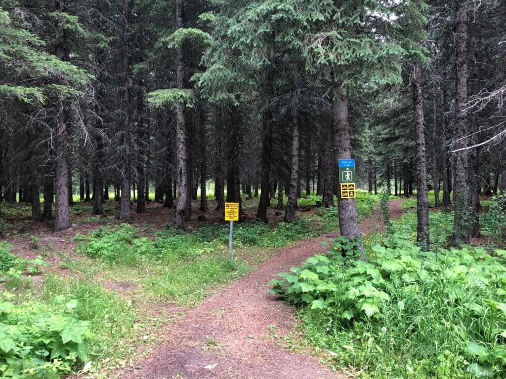
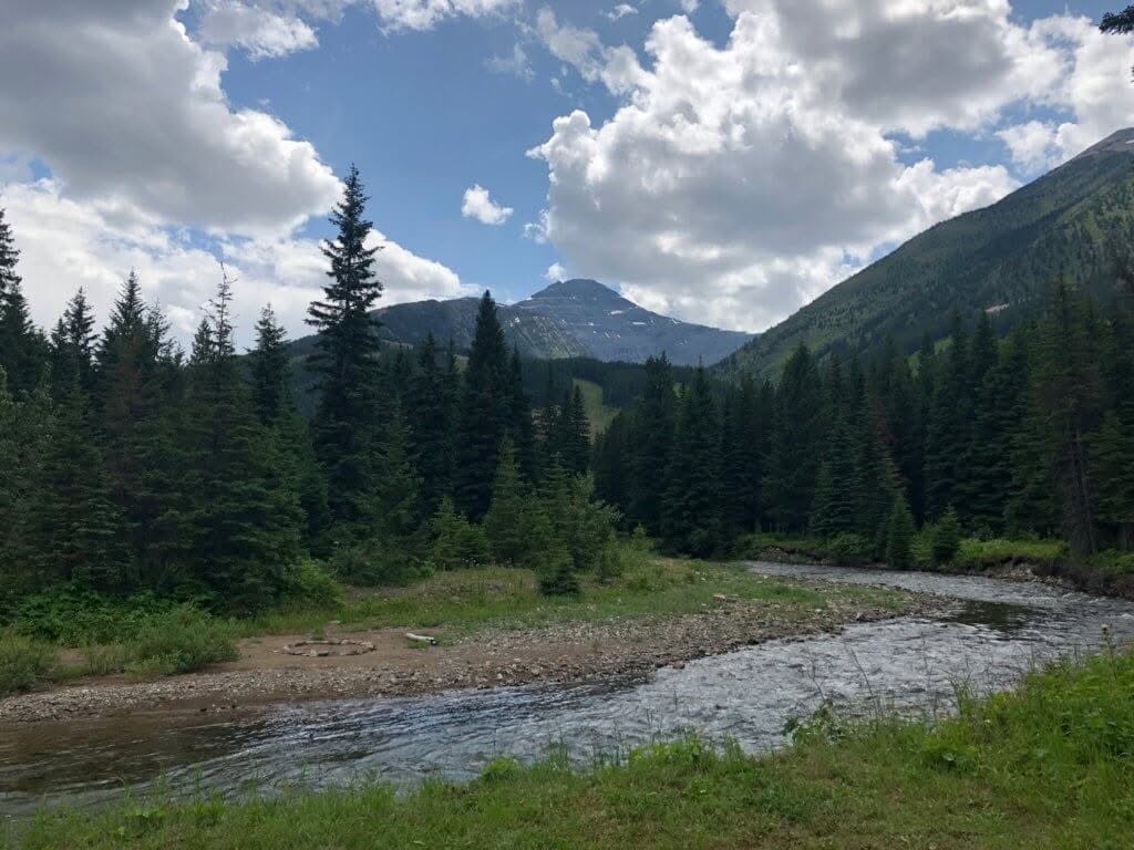
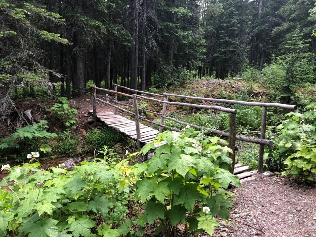
The village trail has been used for decades by residents and visitors alike and is a gentle stroll through forestland adjacent to the West Castle River. The trail has been recently interrupted by a metal guardrail, adjacent to the foot bridge over the river but steps will help you overcome this obstacle.
Our village trail terminates at Pebble Beach where a large tree with a rope swing, enjoyed by generations, once stood. Just recently (summer 2019) the long dead tree was finally unable to bear it’s own weight and fell into the West Castle River where it will continue to decay.

Distance –
3.8 KM (one-way)
Elevation Gain / Loss –
420 meters (1380 feet)
Trail Difficulty –
Moderate
Trail Description –
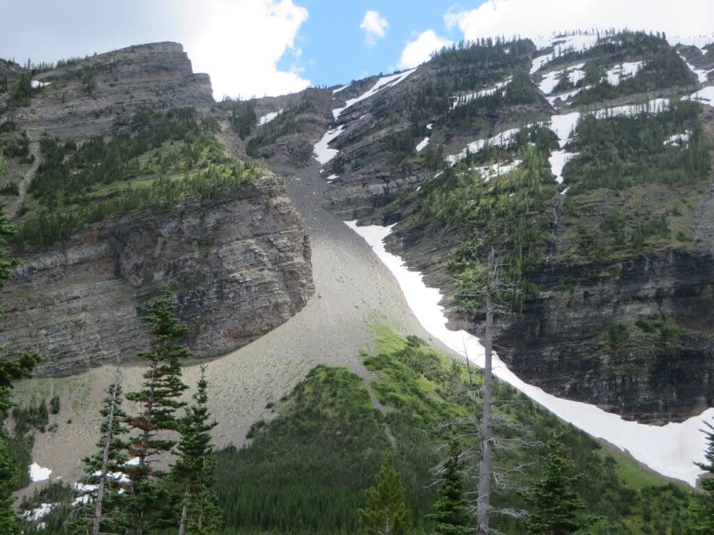
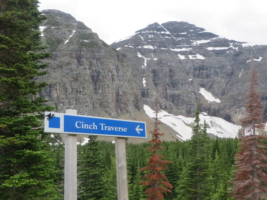
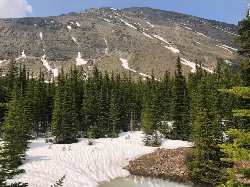
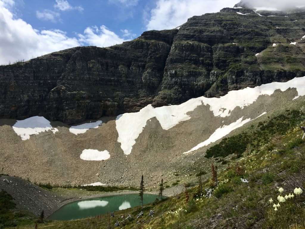
The Haig Lake North Trail is the slightly shorter, more direct cousin of the Haig Lake South Trail and forms part of the Haig Lake Loop. Most commonly, the North Trail is used as the descent trail from Haig Lake back to the village, and makes use of alpine single track and what many might recognize as the “Cinch Traverse” winter ski run before meandering through the forest on the lower third of the hike.
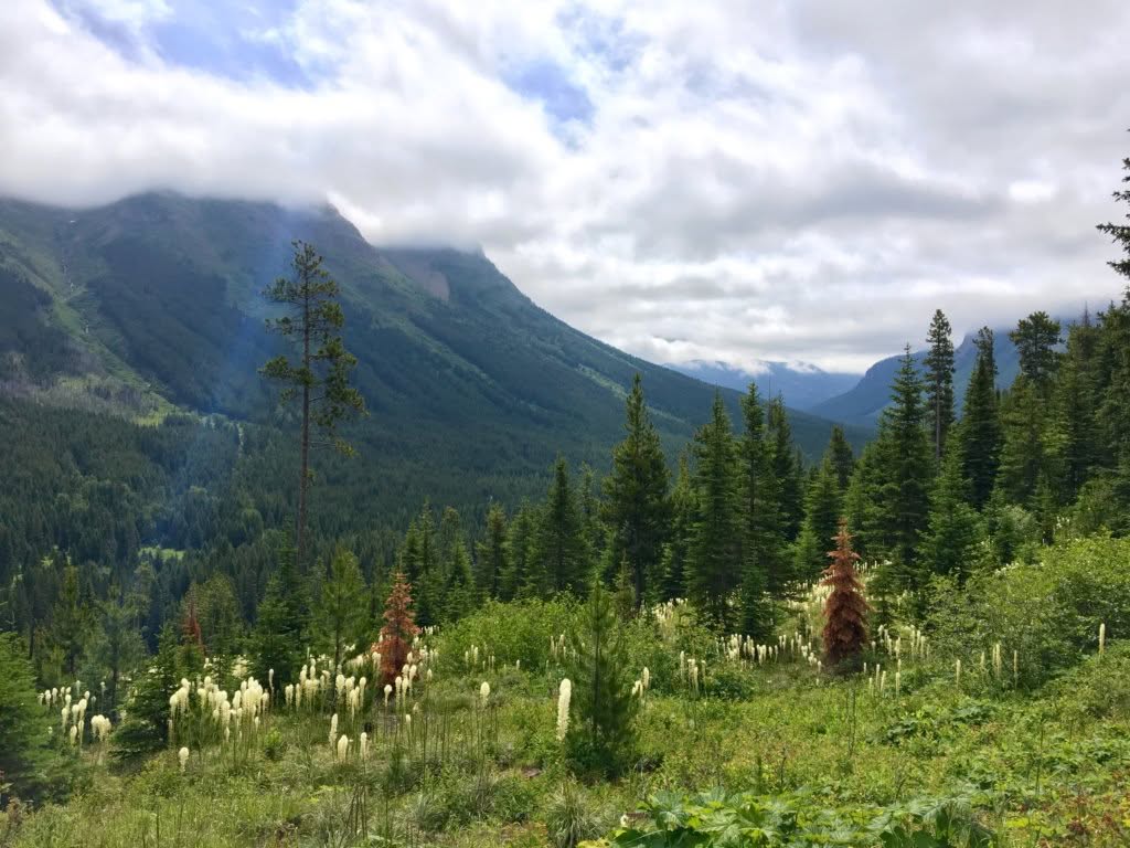
We recommend that the North trail is used as your descent trail back to the village. The North trail is shorter than the South trail and, since they gain / lose the same elevation, this means it’s more difficult to climb the North trail. Aside from this, the upper portion of the North trail meanders through mostly treeless, alpine meadow resulting in amazing views of Southfork Mountain / Barnaby Ridge (you’ll thank us later on this one).
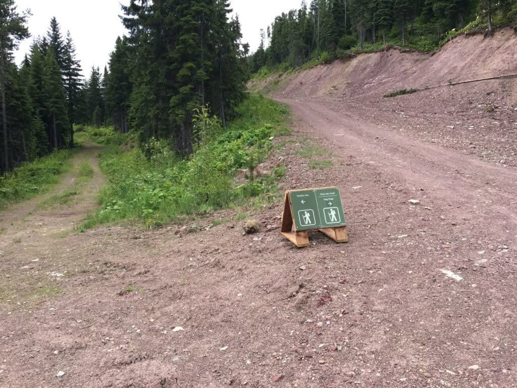
Signage is very present and difficult to miss on this trail. Follow green directional signage + orange hiking trail markers to stay on trail.
Distance –
6.8 KM (one-way)
Elevation Gain / Loss –
940 meters (3085 feet)
Trail Difficulty –
Difficult
Trail Description –
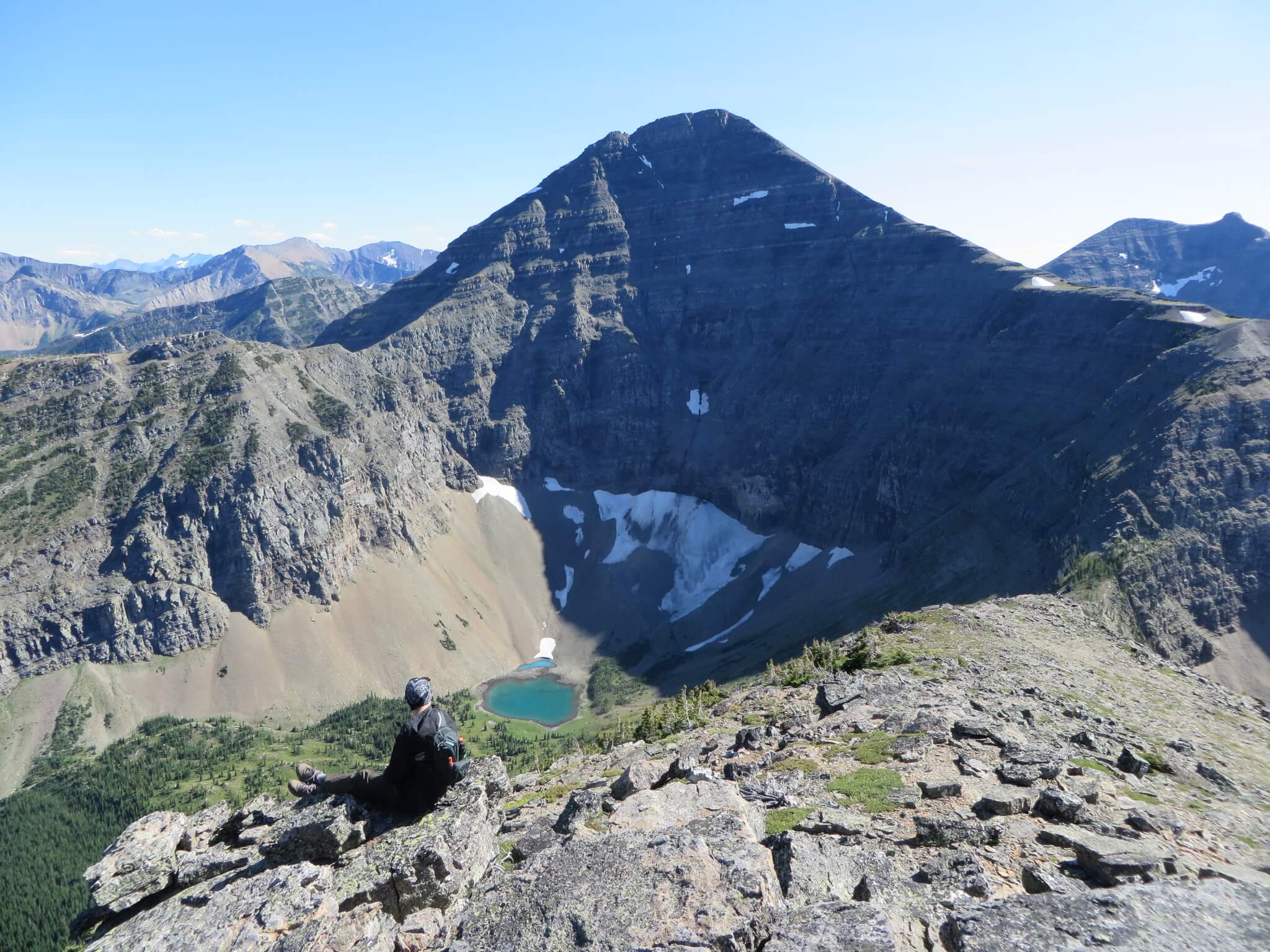
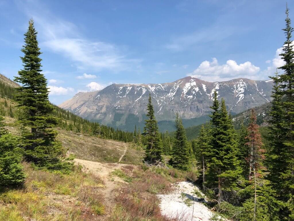
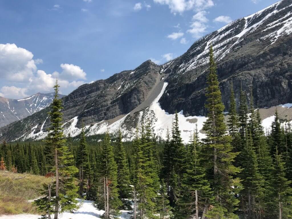
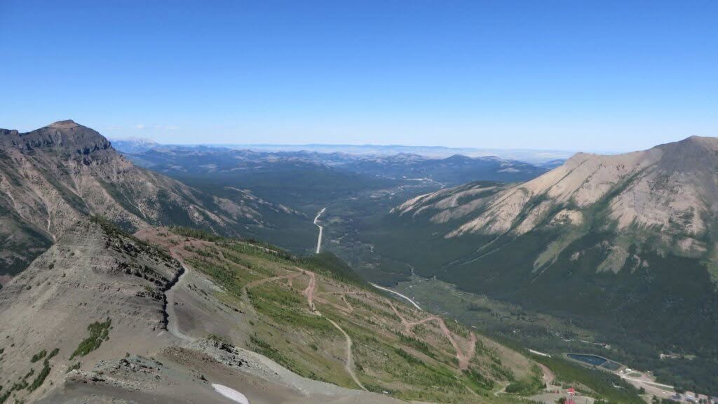
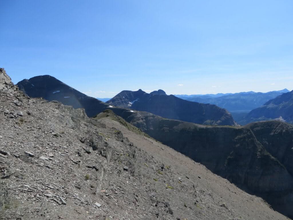
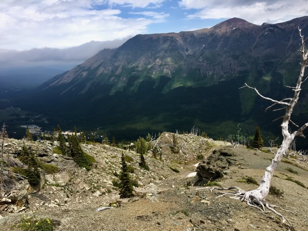
Perhaps the least traveled trail at the resort is the challenging hike / scramble to the top of Gravenstafel Peak; the main mountain for skiing / snowboarding in the winter months at the resort.
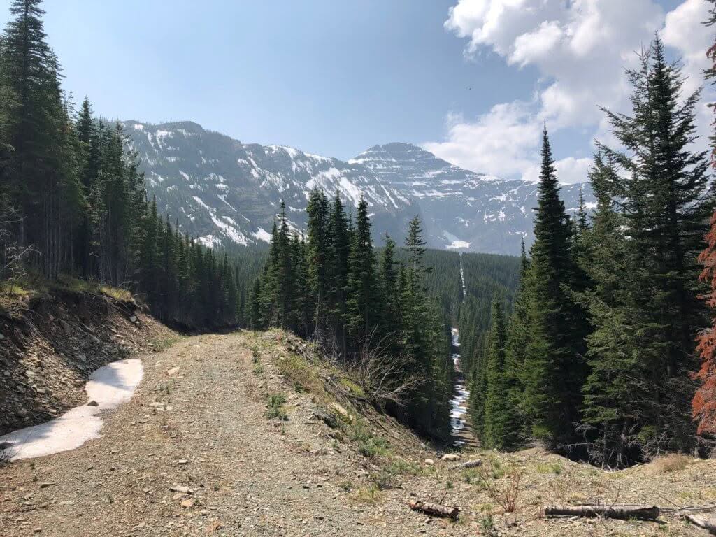
This trail begins in the base area and shares a common trail head with most other trails, starting from the area outside the main lodge / T-Bar Pub. The trail climbs an impressive 940 m (3085 feet) by following Castle’s summer maintenance road to the top of the Tamarack (Red) Chairlift. Veering off the trail, particularly when it reaches treeline, can be tempting. Our suggestion is to stick to the road on the way up, avoiding unpleasant scree climbs and saving your legs for the short scramble above the Tamarack (Red) Chairlift.
Once at the top of the Tamarack (Red) Chairlift, a brief scramble to the top of Gravenstafel Peak is required and no marked trail is available. 360 degree views into the province of British Columbia, the Castle Parks, and the prairies will be enjoyed by those who summit. From the summit, hikers are encouraged to scramble south, towards the top of Castle’s famed “Chutes” terrain, where they will meet up with an excavated snow cat road. From here, Haig Lake / Mount Haig dominate the landscape which is where the epic cover pic for Castle’s trail map is shot.
Distance –
4.4 KM (one-way)
Elevation Gain / Loss –
410 meters (1345 feet)
Trail Difficulty –
Moderate
Trail Description –
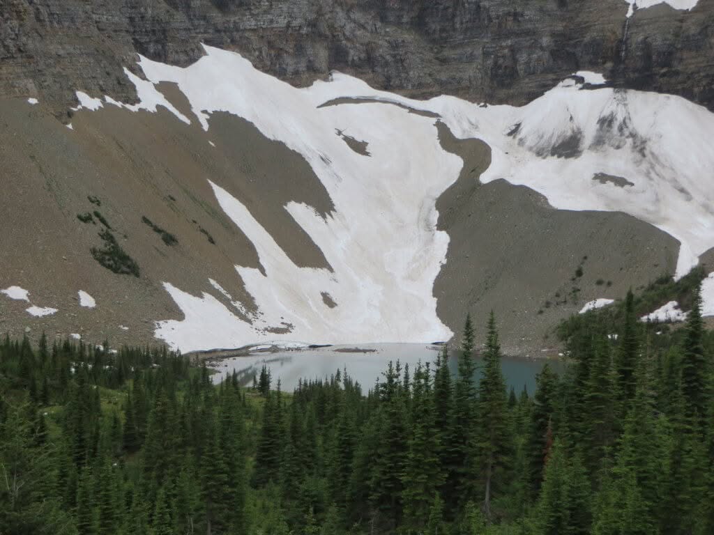
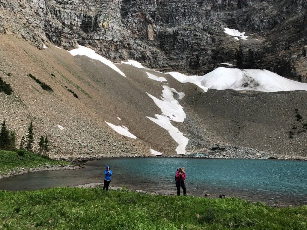
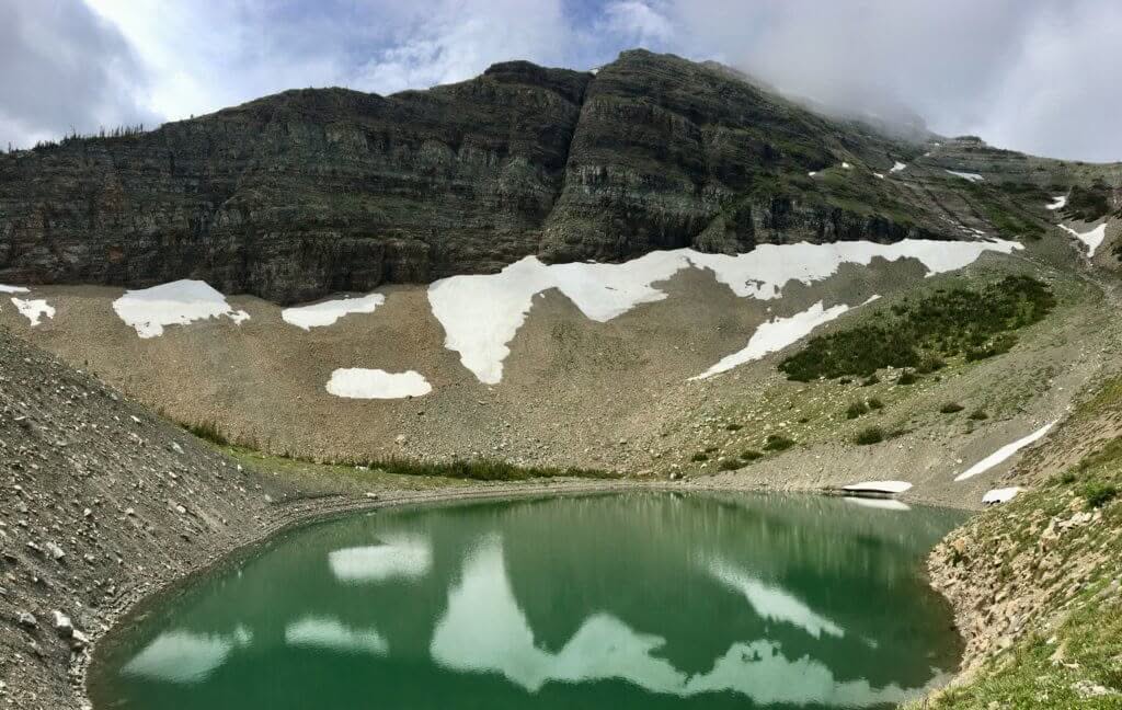
Haig Lake South Trail makes use of a combination of narrow, winding ski trails, historical, exploration cut-lines, and single track to ultimately arrive at Haig Lake. The South trail starts in the base area and gains most of its elevation on the lower third of the trail, within the Huckleberry terrain pod. If you can endure the lower third of this trail then you will make it to the lake!
We recommend the South trail as your route to the lake as a result of the trail making many switchbacks to assist in taking the edge off the elevation gain. This trail links up with “Haig Lake North”, at Haig Lake, which is the recommended route back to the village. This loop is our most popular hike due to breathtaking scenery, lake serenity, and relative ease.
Signage is very present and difficult to miss on this trail. Follow green directional signage + orange hiking trail markers to stay on trail.
Distance –
4.4 KM (one-way)
Elevation Gain / Loss –
435 meters (1430 feet)
Trail Difficulty –
Moderate
Trail Description –
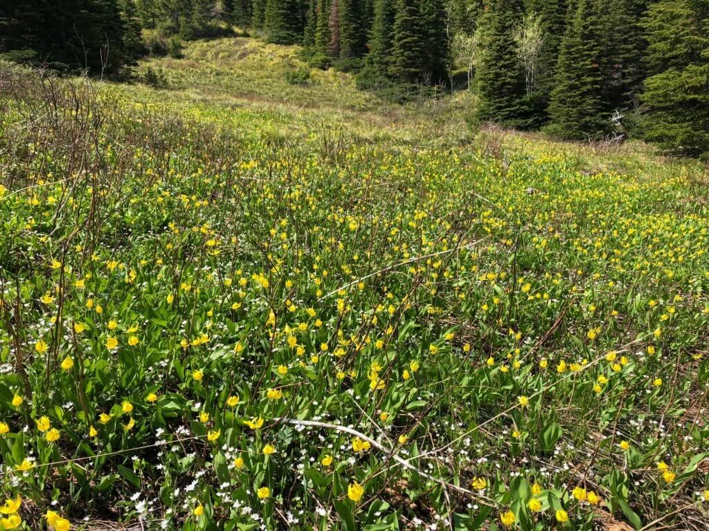
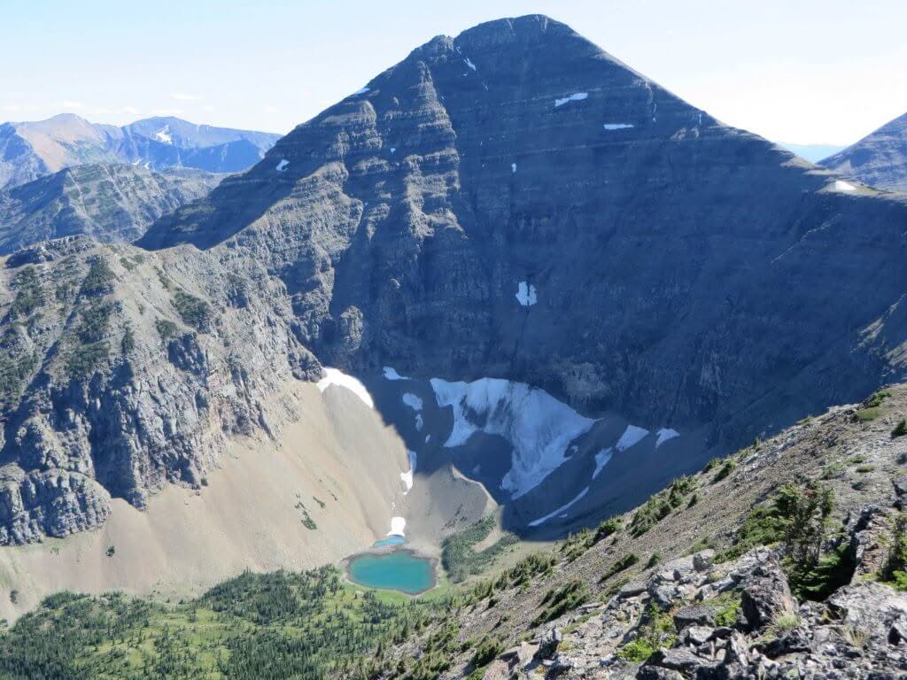
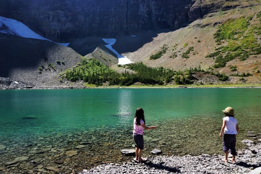
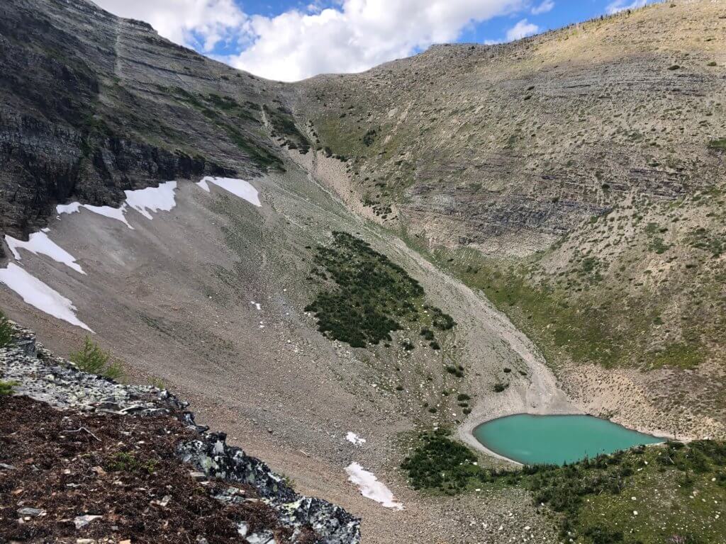
The aptly named Paradise Lake trail takes you on a journey to the lesser known of two alpine tarns on Castle Mountain Resort’s tenure; Paradise Lake. Situated at the base of Mount Haig and on the opposite (south) side of Haig Ridge from Haig Lake, Paradise Lake is adjacent to Castle Mountain’s cat skiing area. This hike is a moderately difficult out-and-back journey.
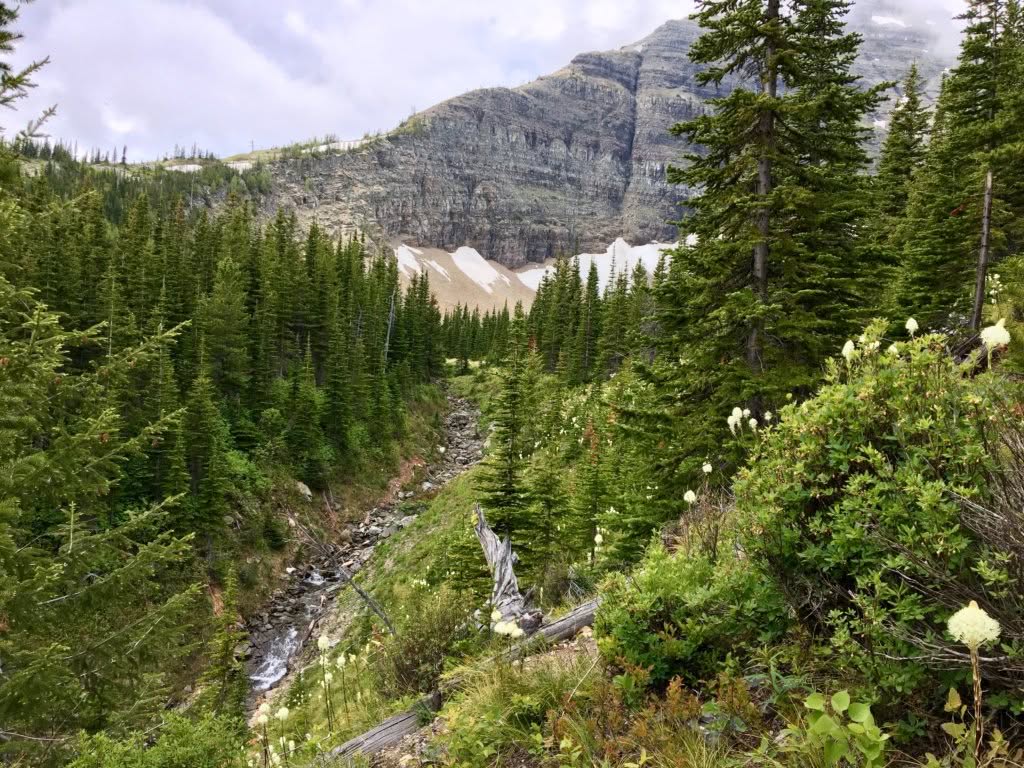
This trail starts from the village in between the day lodge and the T-Bar Pub and shares it’s start with the Haig Lake South trail before veering off to the left past the resort’s snowmaking reservoir. Winter visitors will know this access road as “Skidaddle Traverse”; the catchment run for Castle’s Powder Stagecoach Cat Skiing operation. Great views of the Westcastle Valley can be had before the trail turns sharply and steeply to the west (right), approximately 3.5 km in. Shortly thereafter, signage dictates a left turn is required and the trail begins to meander up to the lake, adjacent to a stream on your left, on single-track. As you begin to emerge out of the tree cover and into alpine meadow, you’ll note that this can be a very active avalanche area. Bent over and snapped in half trees are a constant reminder of winter dangers here.
Travel to Paradise Lake is often best in the late spring / early summer. Unlike Haig Lake, Paradise tends to lose a great deal of it’s water during the heat of summer. We recommend enjoying your lunch / snacks from the hill overlooking the lake.
Distance –
4.6 KM (one-way)
Elevation Gain / Loss –
770 meters (2525 feet)
Trail Difficulty –
Difficult
Trail Description –
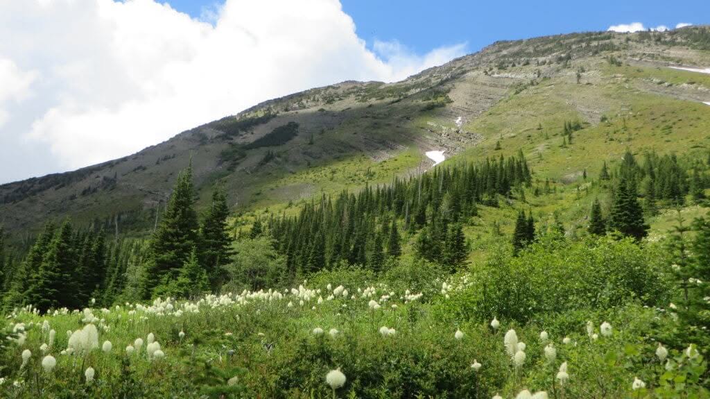
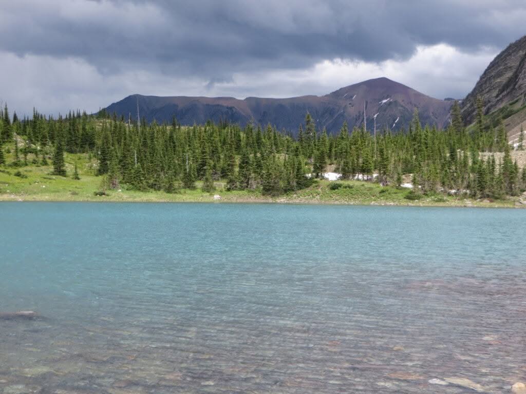
Haig Ridge runs predominantly east – west from the summit of Mount Haig to the top of the Huckleberry Chairlift. The ridge line creates two distinct basins; one in which Haig Lake lies and the other the location of Paradise Lake.
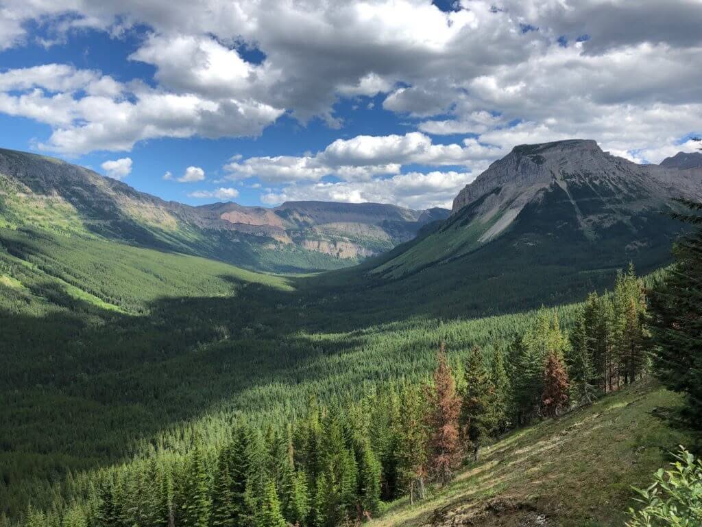
The Haig Ridge trail winds its way up Castle’s summer maintenance road from the base area where it shares the same trail head as Haig Lake North / South and Paradise Lake. Once at the top of the Huckleberry Chairlift the trail continues on the ridge just as Castle’s Powder Stagecoach snow cat would travel in winter. This is where the intensity of the hike really turns up with it being a straight shot up the ridge for several hundred meters, before the trail starts to mellow out.
The views from this out-and-back trail are absolutely spectacular, taking in views of Gravenstafel Peak (the Chutes area of our main mountain), the West Castle Valley, Barnaby Ridge / Southfork Mountain, and all the way through to the prairies. If you’re feeling ambitious, you could tackle this trail and the Haig Lake Loop, all in a day!
Distance –
4.5 KM (one-way)
Elevation Gain / Loss –
650 meters (2132 feet)
Trail Difficulty –
Difficult
Trail Description –
The Mountainside Trail gets its name from the winter ski run that it predominantly follows, on Mount Haig. It is a less direct, slightly less strenuous way to achieve Haig Ridge.
This trail also starts by winding its way up Mount Haig via Castle’s summer maintenance road from the base area, sharing the same route as the Haig Ridge trail until the top of Huckleberry Chair. Once at the top of this lift, you’ll veer left onto Mountainside Road and follow our summer maintenance road in the Stagecoach Express zone, where you’ll zigzag under the lift a couple of times, breaking out into the subalpine before ultimately gaining Haig Ridge and connecting with the Haig Ridge trail.
We recommend using Mountainside as your ascent route and then making a loop out of it by using Haig Ridge trail as your descent route.

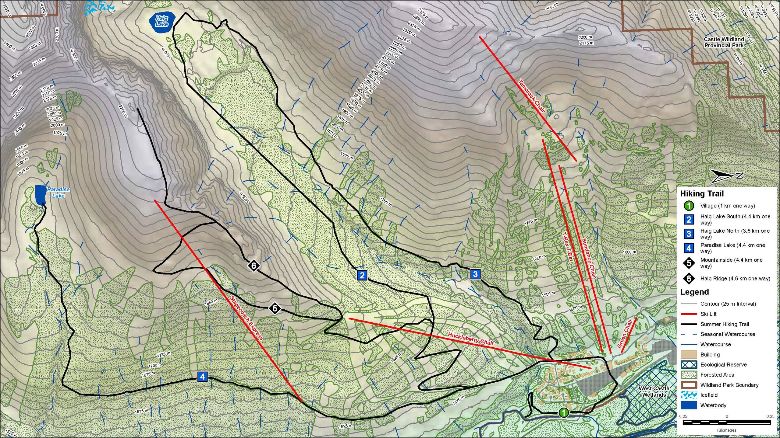
SUMMER TRAIL MAP
Click the link below for our summer trail map. You’ll also find printed copies at the resort itself, at Guest Services and/or at the T-Bar Pub.
GREAT DIVIDE TRAIL
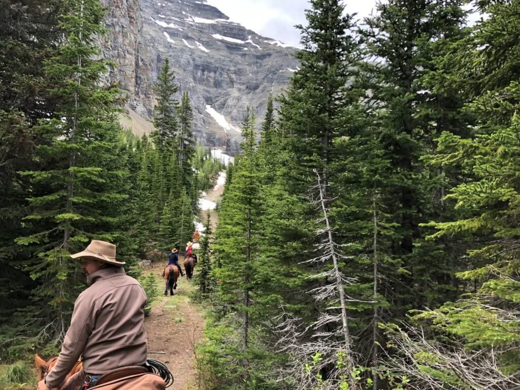
The Great Divide Trail – or GDT for short – is a wilderness hiking trail located in the Canadian Rockies. The trail begins in Waterton Lakes National Park, at the Canada-US border and ends 1095 kilometers to the north in Kakwa Provincial. Castle Mountain Resort is located along the main GDT route in Section A, just before (if heading southbound) or just after (if heading northbound) the famed La Coulotte Ridge / Peak section – often regarded as one of the most difficult days on the entire trail.
The resort serves as a welcome overnight stay (click for accommodation options) or rest day, for many hikers, particularly when the T-Bar Pub is open (click for hours). Resupply services are available (information below).
NOTE: The Barnaby Ridge alternate bypasses Castle Mountain Resort, necessitating a few kilometer backtrack.
Castle Mountain Resort is pleased to provide Great Divide Trail hikers with resupply package handling services. The following guidelines have been developed to assist thru-hikers with safely and efficiently getting packages to the resort and subsequently picking them up:
- A package handling fee of $25 CAD + 5% GST must be paid prior to mailing. This fee is waived in the event that an overnight reservation is made through Castle Accommodations.
- Packages must be sent pre-paid. Packages with duties and/or fees, such as collect on delivery, will be politely declined.
- Packages must include only dry, non-perishable and/or long shelf-life items only.
- Ensure the outside of your package prominently includes your full name, anticipated pick-up date, and/or accommodation reservation # (if applicable).
- Send packages via Canada Post to the following address:
Castle Mountain Resort
PO Box 610
Pincher Creek, AB T0K 1W0
- Note that Castle Mountain Resort receives its mail in Pincher Creek, some 50 kilometers away from the resort itself. As a result, there can often be a day or two delay between the time you may receive a delivery confirmation and your package actually arriving at the resort. We recommend selecting a delivery service that provides an estimated delivery date of at least 1 week prior to your anticipated pick-up.
- Packages will be held for a maximum of 2 weeks (14 days) beyond the indicated pick-up date. After this time, packages not picked up will be discarded.
- Package pick-up is available Monday – Friday from 8:30 AM – 4:30 PM, at Castle Mountain Resort Guest Services, unless an accommodation booking has been made. Packages of guests with accommodations will be placed in their room, on the day of arrival.
- Castle Mountain Resort will not be held responsible for any lost or stolen packages held in its care.
We wish you all the best in the planning of your hike. If you have any further questions or concerns, please call us at 403-627-5101 or email info@skicastle.ca.
SAFETY AND ENVIRONMENTAL INFORMATION
When you’re in the Castle, you’re in bear country. Black bear and, in particular, grizzly bear sightings, occur with regularity in our area. Each year, bear encounters are passed along to us by visitors utilizing our trail network and trails nearby. The best method is to avoid bear encounters, utilizing the following strategies:
- Remain alert.
- Shouting regularly or singing loudly is far more effective than using bear bells.
- Keep your ears open. Do not wear headphones or earbuds while on trails.
- Watch for fresh bear signs. Tracks, scat and digs indicate that a bear has been in the area. Leave the area if the signs are fresh or if you encounter carrion.
- Travel in groups and during daylight whenever possible.
- Keep your dog on a leash or leave it at home.
- Be cautious about bear safety.
- Carry and know how to use bear spray.
- Report bear sightings to Castle Mountain Resort Guest Services at 403-627-5101 or info@skicastle.ca.
Don’t get lulled into a false sense of security. While you may have lots of experience at Castle during the winter months, and be comfortable finding your way around, you’re still recreating in the backcountry and certain winter-time services are not available. Heed the following before heading out.
- Research the trails / routes you plan to take. Never rely solely on social media or apps to plan your trip. While trails at Castle have some signage, it is minimal and should not be relied on alone. Also, things look vastly different here in the summer months than they do in the winter.
- Leave a detailed itinerary with someone you trust. Cell service is largely unavailable in our area. Consider carrying a map, compass, and/or satellite messenger.
- Check local forecasts before heading out and be prepared for sudden changes in weather.
- Pack appropriate equipment for your outing, including but not limited to extra layers, gloves, a hat or a toque, headlamp, adequate food and water, and an emergency shelter.
It’s important to note that Castle Mountain Resort does not provide mountain patrol (rescue) services outside of the winter season. If you need help, call 9-1-1 or hit the “SOS” button on your satellite messenger.
The Castle is a special place. In order to help preserve it for generations to come, we encourage you to practice “leave no trace” principles, including:
- Travel in small group and stay on existing trails
- Dispose of all waste properly
- There are no washrooms on trail. If you need to “go” in the backcountry, you should be prepared to pack it out! Leaving used toilet paper and/or other hygiene products is flat out unacceptable.
- Leave what you find (including rocks, plants, and other natural or man-made objects)
- Respect wildlife
- Never feed wild animals and store your food appropriately
- Observe wildlife from a distance. Do not follow / approach wild animals.
- Be considerate of others
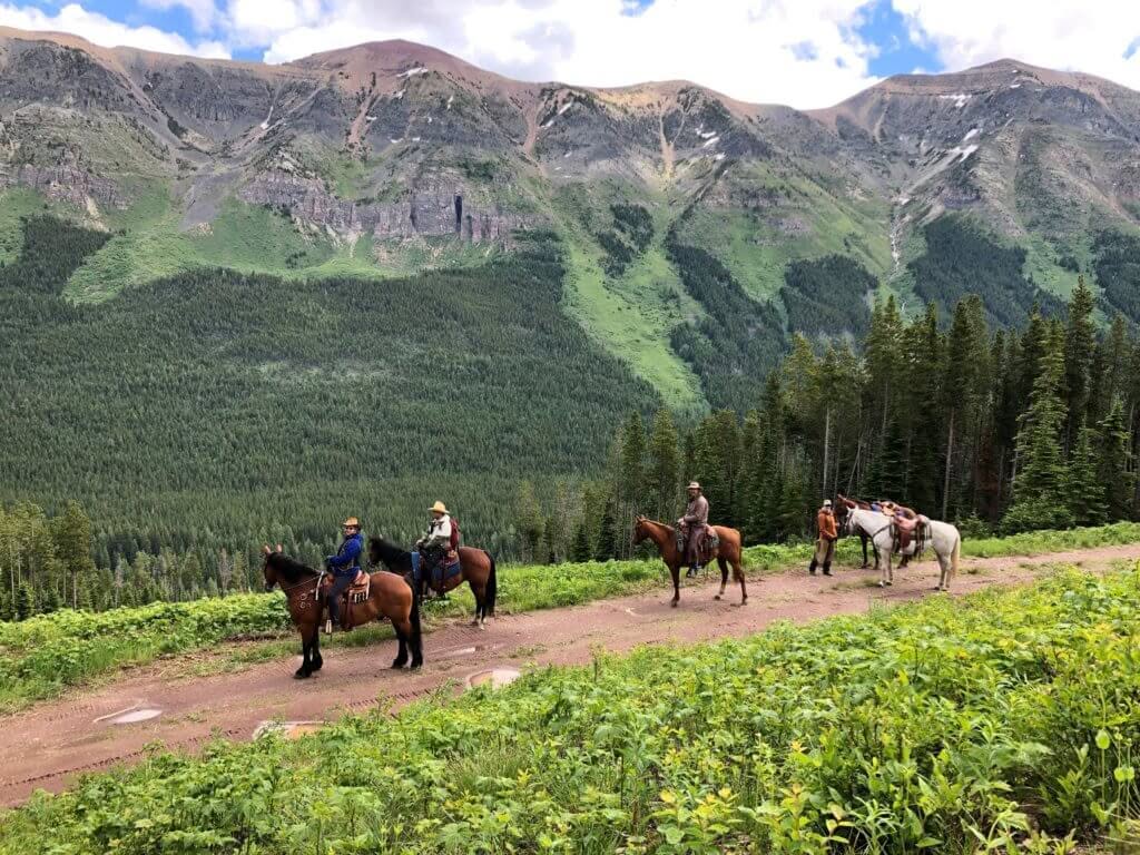
- Step to the downhill side of the trail if you encounter horses.
- Let nature’s sound prevail (leave your music in the car / campsite).